


Storms brought the threat of severe weather Tuesday evening, but they stayed below severe levels, based on reports to KVOE and the National Weather Service.
A handful of severe thunderstorm warnings developed for areas northwest and southwest of Emporia. No severe weather was noted.
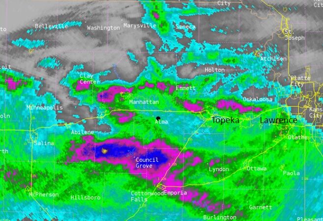
Storms brought heavy rain for well over an hour to parts of northwest Greenwood County, which remains in a flood warning until 9:45 am. Radar estimates had up to 4 inches of rain at the time the warning was extended with another inch of rain possible overnight. Exact measurements are pending.
Heavy rain is underway across northern Lyon, much of Morris and southern Wabaunsee counties, which are now in an urban and small stream flood advisory until 8:30 am. The Weather Service says up to 2.5 inches of rain has fallen with another 1-1.5 inches of rain possible.
Elsewhere across the area, rain totals are varied and spotty.
*KVOE studios: 0.10 inches
*Emporia Municipal Airport: 0.52 inches
*1100 block Constitution: 0.15 inches
Power outages were widely scattered as well. The Cassoday area had close to 170 Evergy customers offline, but those have been restored. There are currently a handful of outages for Evergy customers near Allen and Melvern, but less than 30 cutomers total are without power.
Showers and storms are possible through the lunchtime period Wednesday, with more chances of storms Thursday morning, Thursday night, Friday night and Saturday night into Sunday morning. There is currently a slight to marginal risk of severe weather Thursday.
If you have rain totals, message the KVOE Bluestem Farm and Ranch text line at 620-342-5863.
6:15-11 pm Tuesday: Severe weather coverage period
Strong storms have entered the KVOE listening area with a risk of severe weather attached.
Active warnings
*Greenwood County: Flood warning until 9:45 am. Includes Thrall
6:05 pm Tuesday: Severe thunderstorm watch areawide until midnight
Strong storms are possible across the KVOE listening area Tuesday night.
A severe thunderstorm watch now affects all area counties until midnight. The National Weather Service says storms could generate hail to the size of ping pong balls, or 1.5 inches in diameter, and wind gusts up to 70 mph or the equivalent of EF-0 tornado strength.
OVERVIEW
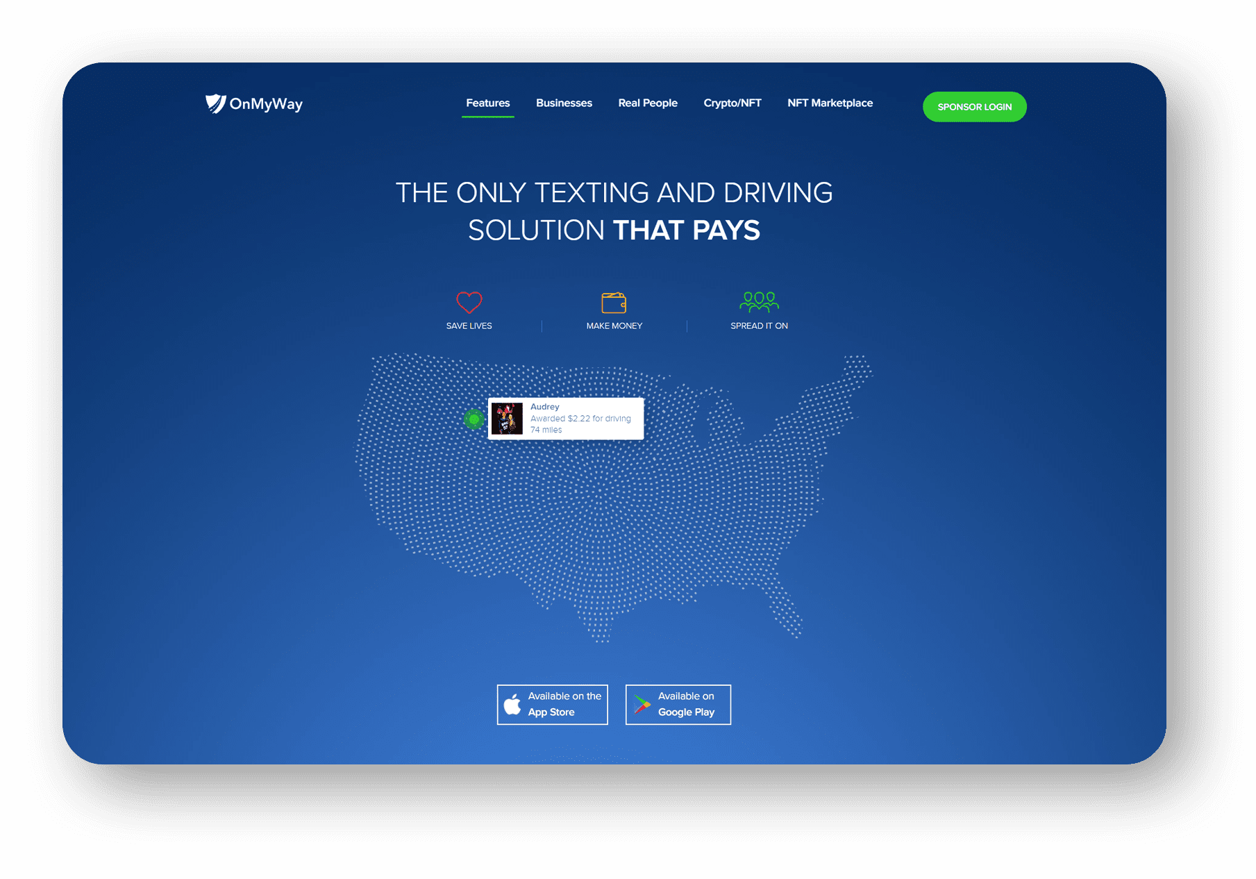
OnMyWay Is The #1 Distracted Driving Mobile App In The Nation!
OnMyWay, based in Charleston, SC, The Only Mobile App That Pays its Users Not to Text and Drive.
The #1 cause of death among young adults ages 16-27 is Car Accidents, with the majority related to Distracted Driving.
OnMyWay’s mission is to reverse this epidemic through positive rewards. Users get paid for every mile they do not text and drive and can refer their friends to get compensated for them as well.
The money earned can then be used for Cash Cards, Gift Cards, Travel Deals and Much, Much More….
The company also makes it a point to let users know that OnMyWay does NOT sell users data and only tracks them for purposes of providing a better experience while using the app.
The OnMyWay app is free to download and is currently available on both the App Store for iPhones and Google Play for Android @ OnMyWay; Drive Safe, Get Paid.
Download App Now – https://r.onmyway.com
Sponsors and advertisers can contact the company directly through their website @ www.onmyway.com.