


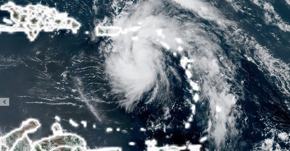
Heavy rain continues to be the biggest threat
Heavy rain was falling Friday morning across eastern Cuba. Heavy rain is the main threat from this storm, as Cuba could see up to 5 inches of rain in some isolated areas.
Even heavier totals are forecast across Florida.
“Heavy rainfall could lead to flooding across southern and central Florida into the Big Bend region through the weekend,” CNN meteorologist Allison Chinchar said.
“Much of the Florida peninsula is expected to be on the east side of Fred, which is where the heaviest rains and strongest winds will be,” the hurricane center said.
From Friday into Monday, 3 to 7 inches of rain is anticipated across the Keys and in southern and central Florida north toward the Big Bend, according to the hurricane center. In isolated spots, up to 10 inches could fall.
“Starting Sunday and through the start of next week, heavy rain will extend into other portions of the Southeast, including Georgia, Alabama and the Carolinas,” Chinchar said.
Grace could be much stronger than Fred
And Fred isn’t the only Atlantic storm drawing attention.
“Kind of like everyone’s favorite player is the backup quarterback, many are already watching the next disturbance behind Fred,” CNN meteorologist Brandon Miller said.
That tropical disturbance, several hundred miles east of the Lesser Antilles, has become better organized and is now Tropical Depression Seven, according to the National Hurricane Center. It is expected to strengthen into a tropical storm Friday night and will be named Grace.
This would be the seventh named storm of the season.
New tropical storm watches have been issued for the US Virgin Islands and Puerto Rico, including Vieques and Culebra, Anguilla, the British Virgin Islands, St. Martin and St. Barthelemy. These come in addition to tropical storm watches issued Friday morning for Antigua, Barbuda, St. Kitts and Nevis, Montserrat, Saba, and St. Eustatius.
A tropical storm watch means that tropical storm conditions are possible within the watch area within the following 48 hours.
The storm is expected to move through the Leeward Islands Saturday night, impacting Puerto Rico and the US Virgin Islands on Sunday. Tropical-storm-force winds — of at least 39 mph — and three to six inches of rain are expected in these areas through the weekend.
This may be the next hurricane of a season predicted to be above-average, computer forecast models suggest.
“The secondary system has the potential to be a stronger storm than Fred,” Chinchar said. “Many models are hinting that Grace could reach hurricane status, potentially Category 2 or 3 strength. A lot of that will depend on the track that storm takes, which at least for now appears to be farther east than Fred.”
The forecast from the National Hurricane Center has the storm peak as a moderate tropical storm due to potential land interaction with Puerto Rico and Hispaniola, which would limit its potential intensity.
A lot can change over the next several days, and this is a storm to keep an eye on.
OVERVIEW
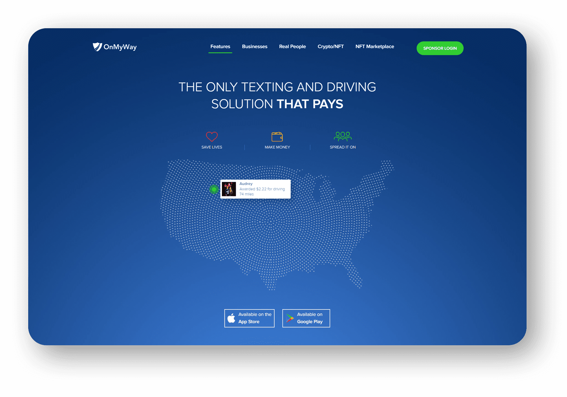
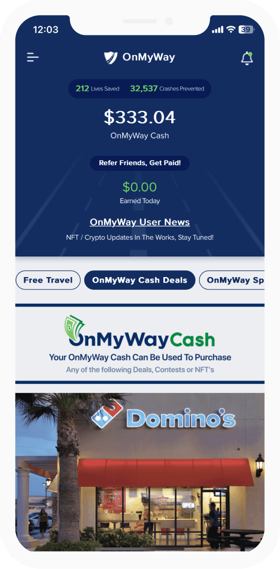
OnMyWay Is The #1 Distracted Driving Mobile App In The Nation!
OnMyWay, based in Charleston, SC, The Only Mobile App That Pays its Users Not to Text and Drive.
The #1 cause of death among young adults ages 16-27 is Car Accidents, with the majority related to Distracted Driving.
OnMyWay’s mission is to reverse this epidemic through positive rewards. Users get paid for every mile they do not text and drive and can refer their friends to get compensated for them as well.
The money earned can then be used for Cash Cards, Gift Cards, Travel Deals and Much, Much More….
The company also makes it a point to let users know that OnMyWay does NOT sell users data and only tracks them for purposes of providing a better experience while using the app.
The OnMyWay app is free to download and is currently available on both the App Store for iPhones and Google Play for Android @ OnMyWay; Drive Safe, Get Paid.
Download App Now – https://r.onmyway.com
Sponsors and advertisers can contact the company directly through their website @ www.onmyway.com.

OnMyWay is the Only Texting and Driving Solution That Pays
Trusted and  By Millions of OnMyWay Mobile App Users